Chat
Shahanur Islam Shagor
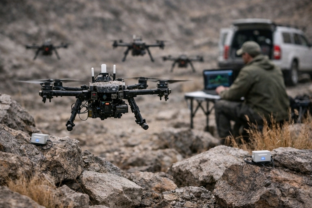
Under the Hood of GPS-Denied Autonomous Swarms: Navigation, Mapping & Zero-Trust Security
What actually happens when drones lose GPS in hostile environments? This deep dive breaks down how autonomous swarms continue to navigate, map, and secure themselves without relying on satellites. From Visual-Inertial Odometry (VIO) and keyframe-based SLAM to a zero-trust security architecture, this research explores how drones achieve real-time localization, recover from disorientation, and defend against hijacking attempts. Built with high-performance systems like ROS2, secure communication protocols, and advanced sensor fusion, this approach pushes autonomous systems toward resilience in the most extreme conditions.
Article Details
Structured for reading, reference, and practical implementation takeaways
This article view follows the same polished long-form layout style as the other detail pages, while keeping the reading area focused and the supporting context easy to scan.
Under the Hood: How a GPS-Denied Autonomous Swarm Actually Works?
I am often asked, "How does a drone know where it is without GPS?" or "How do you prevent a drone from being hijacked in a high-jamming environment?"
In today’s, I’m breaking down the three core mechanisms of my current research into resilient autonomous systems:
1. Navigating Without Satellites: Visual-Inertial Odometry (VIO)
When GPS is denied or jammed, the drone relies on its onboard Camera and IMU (Inertial Measurement Unit). The camera tracks environmental features frame-by-frame, while the IMU measures velocity and acceleration. We fuse these two data streams using an Extended Kalman Filter (EKF).
The Result: The drone can perceive its movement with centimeter-level precision in real-time, completely independent of external signals.
2. Mapping the Unknown: Keyframe-based SLAM
The drone doesn't just fly; it creates a digital twin of its surroundings on the fly. This is known as SLAM (Simultaneous Localization and Mapping). By building a map in real-time, the drone can perform Visual Relocalization. If it ever loses its orientation, it compares its current view with previously mapped "keyframes" to instantly recover its position.
3. Zero-Trust Security: The 9-State Security Machine
Autonomous flight is a liability if it isn't secure. I have implemented a 9-State Security Machine that forces the drone to constantly verify its own "Trust Level." At every millisecond, the drone asks:
Is this command cryptographically valid? (Signed Commands)
Is the communication link authenticated? (mTLS 1.3)
Is this a replay attack? (Nonce & Timestamp Validation)
If any anomaly is detected, the drone instantly transitions its state to 'Isolated Autonomy,' cutting off untrusted inputs and returning to a pre-defined safe zone autonomously.
My research at the intersection of Robotics and Cybersecurity aims to bridge the gap between high-level autonomy and low-level system resilience. By combining C++20 for performance, Go for secure backends, and Advanced Sensor Fusion, we are building swarms that can "think" and "protect" themselves in the most hostile environments.
Tech Stack Highlights:
Onboard: Jetson Nano/Orin, C++20, ROS2/MAVROS.
Communication: mTLS, Fast-DDS, UDP Encrypted Mesh.
Security: Ed25519, Monocypher, SHA-3.
The journey from lab-controlled testing to real-world field deployment is full of challenges, but every iteration brings us closer to a truly unhackable, unjammable autonomous future.
Article Discussion
Comments and replies
Leave a Comment
Join the discussion
Article Discussion
Comments and replies
Leave a Comment